

")


Topcon HiPer VR GPS
The Topcon HiPer VR GPS gets all signals, all satellites and all constellations — in a compact, rugged design, with an integrated IMU and eCompass.
Description

The Topcon HiPer VR GPS is compact, light and packed with the most advanced GNSS technology in a design built to withstand the harshest field environments. Using Topcon’s advanced GNSS chipset with Universal Tracking Channels *technology, the HiPer VR automatically tracks every satellite signal above – now and into the future.
All signals, all satellites and all constellations — in a compact, rugged design, with an integrated IMU and eCompass.
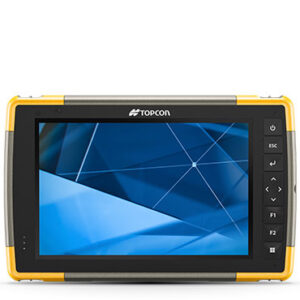
The HiPer VR is a complete solution and versatile in many ways. It can be used for static or kinematic GNSS post-processed surveys, as a network RTK rover with the FC-5000’s internal 4G/LTE cellular modem, as a UHF/FH/Longlink jobsite RTK rover, and also in Topcon’s patented Hybrid Positioning workflow.
Features
- Universal tracking technology for all satellites and constellations (GPS, GLONASS, Galileo, Beidou, IRNSS, QZSS, SBAS) covering all modernized signals
- Field tested, field ready IP67 design
- Compact form factor ideal for Millimeter GPS and Hybrid Positioning
- Revolutionary 9-axis IMU and ultra-compact 3-axis eCompass
- Integrated 400 MHz UHF Tx/Rx Radio Modem
- Integrated License free 900 MHz Radio Modem, FH915 protocol 1
TILT™- Topcon Integrated Leveling Technology The HiPer VR incorporates a revolutionary 9-axis Inertial Measuring Unit (IMU) and an ultra-compact 3-axis eCompass. This advanced technology compensates for mis-leveled field measurements out of plumb by as much as 15°
Do you have any more questions? Fill out the form below.
Additional information
| Weight | 12 lbs |
|---|
Related Products
More Products-
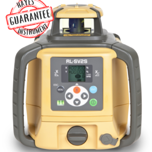
Topcon RL-SV2S Dual Slope Laser with LS-80X Detector
$2,466.00 – $2,583.00 -
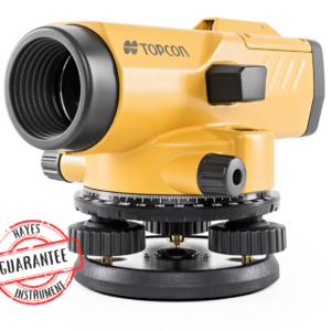
Topcon AT-B2 Automatic Level
$1,060.00 -
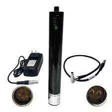
Gps External Pole Battery
$250.00 -
Topcon AT-B4A Automatic Level
$240.00


Reviews
There are no reviews yet